Budget cuts could hurt Appalachian Trail
ENVIRONMENT. The National Park Service and U.S. Forest Service are major public partners of the organization that has overseen management of the trail for 100 years.
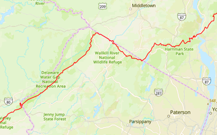

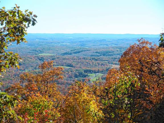
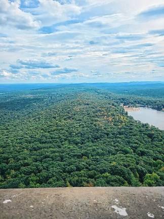

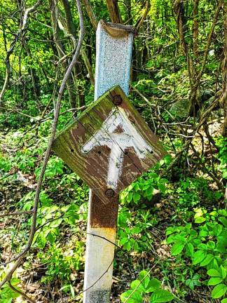
The Appalachian Trail. For many in this area, it means a trip up to Sunrise Mountain in Stokes State Forest, where on a clear New Jersey day, neighboring states New York and Pennsylvania beckon in the distance.
For avid hikers, the Appalachian Trail represents one of the greatest challenges in the contiguous United States: nearly 2,200 miles of trail through 14 states.
For those skilled and fortunate enough to thru-hike or section-hike the entire trail, it provides an astonishing cumulative total elevation change of 464,000 feet over terrain that ranges from bare peaks and rocky glacial outcrops to marshy wetlands and includes every landscape in between.
The Appalachian Trail Conservancy (ATC), which has overseen management of the trail for 100 years, reports that 996 hikers completed the route in 2024, bringing the number of registered “2,000-milers” to more than 21,000 since the trail opened in its entirety.
Possible budget cuts
While celebrating the hikers who’ve achieved finisher status, the ATC also reports concerns about the potential loss of millions of dollars that help preserve the trail should the proposed 2026 federal budget be approved by Congress and signed by President Trump.
Because the trail is not a designated national park but instead is considered a unit of the National Park Service (NPS), the ATC’s concern is that what money is left after stark budget cuts could render Appalachian Trail maintenance a non-priority.
In a statement released May 6, ATC president and chief executive Sandra Marra addressed the proposed $1.83 billion slash in funding to the NPS and U.S. Forest Service (USFS); both are major public partners of the trail organization.
These agencies assist with stewardship, invasive-species control, rule enforcement, and other environmental management and hiker safety tasks along the length of the trail.
“Thinking about our parks and forests in isolation and not as fundamentally connected is in opposition to the reality of the Appalachian Trail,” Marra said, “Reorganizing the agencies to impede their ability to see and serve the big picture will degrade management of our public lands and compromise the consistent administration of the trail required by the National Trails System Act.”
On paper, the Appalachian Trail is a cooperatively maintained public recreational area, but at its heart is the spirit of collaboration from which it sprang, the same spirit that draws people to walk its route year after year.
Understanding and honoring the history of the trail contributes to a better understanding of why these partnerships have been so critical in continuing to breathe life into the century-old pathway.
Born in Sussex County
Although the Appalachian Trail begins and terminates in Georgia and Maine, it has the distinction of being born in Sussex County, N.J., in 1921.
Conservationist and planner Benton MacKaye, the very first graduate of Harvard University’s forestry program, was inspired by Vermont’s Long Trail and the Green Mountain Club to establish a new long-distance trail that would run the length of the Appalachian Mountains.
MacKaye, grieving the untimely loss of his young wife, accepted an invitation from concerned friends to join them for a retreat at the Hudson Guild Farm (now Hudson Farms) on the Andover/Hopatcong border.
During that July 1921 gathering, he proposed his ideas for the trail - a place where people could hike at will and commune with nature away from the growing bustle and burden of 20th-century life.
With encouragement from his peers, he submitted the concept in an article titled “An Appalachian Trail: A Project in Regional Planning,” published in the October 1921 issue of the Journal of the American Institute of Architects.
The article was positively received by the outdoors and conservation community, and planning began soon after.
In 1923, the first section of the Appalachian Trail was completed by volunteers on Bear Mountain in New York’s Hudson Highlands.
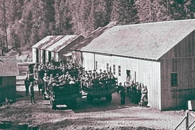
With the knowledge that forging the extensive trail would require monumental efforts, the Appalachian Trail Conservancy (then the Appalachian Trail Conference) was created in 1925. It took more than 16 years from the trail’s first signature white blazes to clear and connect each section, using the combined efforts of the ATC, volunteer trail club members and the Civilian Conservation Corps (CCC).
The CCC, a public work relief program that was part of President Franklin Roosevelt’s New Deal, offered jobs to young unemployed men during the Great Depression.
Locally, the CCC built the familiar Sunrise Mountain pavilion and cleared much of the land in what is now High Point State Park, host to 18 miles of the Appalachian Trail in New Jersey.
CCC crews also were employed on stretches of the trail in eastern Pennsylvania, where they were tasked with building shelters, and in New York, where they constructed fire towers and blazed trailways.
The trail was officially dedicated in August 1937, and a 1938 agreement led to the formation of the unique public-private partnership between the ATC, National Park Service, U.S Forest Service, state-level agencies and regional trail clubs to maintain the trail.
Designated as part of the National Trails System by an act of Congress in 1968, the land comprising the trailway and its surrounding corridor since has been acquired and permanently protected.
That protection is important, with or without federal funding, to support the NPS’s and USFS’s roles in maintaining the trail without putting undue strain on the nonprofit trail clubs.
A lasting treasure
More than 30 clubs now are part of the ATC network, including the New York-New Jersey Trail Conference, Delaware Valley Appalachian Mountain Club and Keystone Trails Association.
These clubs do spring cleanups and perform maintenance tasks as best as they can to keep the trail clean, safe and free from invasive species.
With the days getting warmer and longer, numerous regional access points to the trail provide a tremendous opportunity to get out and enjoy its beauty for a few hours, a day, even an overnight trip.
Nick Stefano is a weather archivist and founder of Sussex County Weather. He maintains and monitors weather stations throughout the county, including at High Point State Park, that feed data to the state climatologist’s office.
He’s also an avid outdoorsman who has lived near the Appalachian Trail for more than 30 years. He offered advice for those looking to take to the trail this spring and summer, perhaps for the first time.
“Check the live radar on your phones! Keep an eye on the weather because you don’t want to be unprepared for rain, especially a sudden thunderstorm. When things change quickly, that’s when it can become dangerous,” said Stefano, ever the weatherman.
On a personal note, he added, “Get out there! We’ve got amazing wildlife; go see it! Go and enjoy our beautiful trail. It’s right there for everyone to use.”
Find a hike near you
Here are popular regional access points in northern New Jersey, southern New York and eastern Pennsylvania:
New Jersey
High Point State Park: Follow signs for the entrance off Route 23, and park at the. trailhead lot 0.5 miles south of the park office. Use the blue trail connector and the red Iris trail to reach the Appalachian Trail to hike north toward New York or south toward Sunrise Mountain.
Sunrise Mountain/Culver Fire Tower: Sunrise Mountain Road is easily accessible from Route 206 and Upper North Shore Road. Park at the bottom in the Culver Gap lot and hike to the Fire Tower or park at the top and take a short walk to the CCC Pavilion - or make it a loop! Sunrise Mountain Road is one-way for motor vehicles, so expect to follow signs back down to exit through Stokes State Forest farther up Route 206. Overnight parking is allowed via permit at the Culver Gap lot.
Delaware Water Gap National Recreation Area: Take Route 80 to Exit 1 - Dunnfield parking lot. From there, use the AT loop and the Red Dot Trail to access Mount Tammany. For a longer hike, also visit Sunfish Pond. This is a moderate to difficult hike with rugged terrain. Alternatively, use the same parking access to hike the opposite direction to summit Mount Minsi for views of the Water Gap and Mount Tammany.
New Jersey/New York
Appalachian Trail Boardwalk, Pochuck Suspension Bridge, Stairway to Heaven and Pinwheel’s Vista: To hike this entire sequence, begin at the McAfee-Glenwood Road parking lot in Vernon. There are also parking areas on Route 94 and County Route 517 to break the hike into shorter outings. You also may access Pinwheel Vista from the New York side by parking in the Bellvale Mountain lot on Route 17A in Greenwood Lake.
For information on any of these hikes or additional Appalachian Trail access points in New Jersey, go online to njhiking.com, select North Jersey Hikes from the Find A Hike dropdown menu, then click the green hiker icon to see the full list.
New York
Harriman State Park: Use access trails to “create your own loop” with varying degrees of difficulty. Seasonal parking fees may apply.
Bear Mountain State Park: Access parking near the Bear Mountain Inn to hike the very first section of the trail, newly restored with more than 1,300 granite stairs. Seasonal parking fees may apply. Steep sections lead to views of the Hudson and the Bear Mountain Bridge, which has a pedestrian sidewalk to carry hikers to the next portion of the trail to the east.
Mount Peter: Pull-off parking near the Mount Peter Ski Area with moderate hiking for payoff views.
Pennsylvania
Fox Gap, Kirkridge Shelter, Nelson’s Overlook and Totts Gap: Park at the Fox Gap lot on Route 191 in Bangor. The trail leads first to the Kirkridge Shelter, which is the last Appalachian Trail shelter on the eastern Pennsylvania portion of the trail. Nelson’s Overlook is less than a mile past the shelter turnoff, and Tott’s Gap offers views of the Delaware Water Gap. Be aware that there are rocky portions along this hike.
Lehigh Gap: There are three convenient access points to the Appalachian Trail near the Lehigh Gap - off-road parking at Lehigh Gap or Lehigh Furnace Gap or onsite parking at the Lehigh Gap Nature Center. Visit the center’s website at lgnc.org/trail-map-and-guides to learn more about hiking this portion of the trail.
Have fun and stay safe on your Appalachian Trail adventure!